I've had some really nice notes of congratulations to our efforts, so some people are still reading this blog and I thankyou all for the compliments. I'm now feeling very embarrassed!
I put it down to being a wimpish sailor, really. I had three rules (a) don't go to sea if there's a sniff of F6 in the forecast, (b) don't sail at night and (c) try to go round pointy bits at slack tide, preferably during neaps!
I think the tributes should really go to the design and build quality of the boat. Despite being in a few uncomfortable situations (mainly because I ignored rule (a)), I've had every confidence that the boat will "take it". OK, a few things didn't work as well as expected (roller reefing - now fixed) but nothing broke at a critical moment. My confidence in the boat has been increased by the adoption of the "spreader" mast configuration. It has stiffened the rig considerably and (I think) improves the upwind performance too.
I wouldn't want to do it in an open boat. The idea that I was carrying with me a snug cabin, that would be available to me once we had got somewhere quieter, buoyed me up a few times!
Vagabond is now in a barn in Buckinghamshire, beside a renovated Gypsy caravan and the body of an old Bentley that has seen better days.
Vagabond is looking a bit the worse for wear, too. Her rubbing strips have been rubbed several times and the gel coat has a few crazes and biffs. The sails probably need cleaning and several pieces of cordage need replacing. As for Freddie, he's covered in salt, needs a wash and another service. Doris is in her cover and probably growing some excellent strains of mould.
I'll have to pay them all some attention in the next few weeks.
Sunday 29 June 2014
Friday 27 June 2014
Stop Press - full mileage now computed.
I take it all back - the GPS was not in a sulk, nor was it an example of built in obsolescence - it was just missing a fully charged battery.
This means that I can now publish the full mileages for each year and the grand total - you can see these on the map but, to save you a click or two the full mileage (in nautical miles) was:
2125
As it took us 3 years, that's an average speed of about 2 miles a day!
This means that I can now publish the full mileages for each year and the grand total - you can see these on the map but, to save you a click or two the full mileage (in nautical miles) was:
2125
As it took us 3 years, that's an average speed of about 2 miles a day!
Wednesday 25 June 2014
GPS in a sulk
After our arrival at Balvicar on Saturday, I spent Sunday cleaning the cabin, repairing the brake cables on the trailer* and debating with myself as to whether I should replace the wheel bearings whilst I was at it. Sloth won out, so we are now jouneying south on the original bearings.**
(I also did a bit of plumbing in the cottage - but that's another story).
On Monday, Mike and Graham, the helpful father and son who own and run the Balvicar boatyard, hauled her out of the water, postioning her with millimetric precision on the trailer; the water ballast drained away. The mast came down, Doris was deflated, halliards unreeved, various ropes and stays tied down and we were ready for the journey.
Off on Tuesday morning.
Then the trailer light board fell off and dragged along the road. It took some time for this to be discovered......
Eventually to Pitlochry, for dinner with the Scottish herbalist, a discussion on the outcome of the forthcoming referendum and various other seemingly more important issues. Vagabond spent the night in the company of a number of spare caravans owned by the local caravan park.
Then, after a good nights sleep, home for me and to the barn in Buckinghamshire for Vagabond, in two stages.
This evening, after dining in an hotel, I thought I'd turn on the Garmin GPS and down load the track of the voyage, so I can publish more intimate details of our progress in future editions of this blog.....
I discovered that the device has gone into a sulk. It tells me it needs to have it's software reloaded, yet resoutely will not connect to a PC. It's now rated "unsupported" by it's manufacturer and I bought it just three years ago***.
Does it know it's work is done, or is this some terrible example of built in obsolescence by the manufacturer?
Footnotes
* I think I had forgotten to mention on this blog that both cables had failed whilst the trailer was parked during the winter
** fingers crossed, wood touched and salt thrown over left shoulder etc
***well, it was a bargain at the time!
Sunday 22 June 2014
And back to Balvicar
Friday dawned bright and fair (to be really fair, it hardly became dark overnight*) with the promise of the continued north westerly breeze. Just right for going down the Sound of Mull. The tide would be fair, too, from about 11:00 onwards. So, rather than wait a day (even with the prospect of participating in the reopening of the pub), we set off at about half past ten. The sail were hoisted in the harbour and we turned down the sound. The tide was racing us along but the surface was reasonably settled. So the sails were set in a goosewing, we sailed slightly by the lee and romped down the channel. Despite the twists and turns of the sound, the wind stayed just behind my left ear and we were down the sound in no time at all. We passed through some turbulent water as we joined the Firth of Lorn(my 25 theory again) and crossed the firth and into Oban Bay and Kerrera marina for a quick overnight stop. Then south down the Sound of Kerrera, dodging past the MV Polaris, laying a buoy or two and back into the Firth. The two yachtrs in front of me headed straight for the favourite anchorage** to the north of the "Bridge over the Atlantic".
We headed past the north side of the Island of Seil and came upon the entrance to Easedale.
The yellow arrow at the top left of this chartlet shows the entrance

This offered a short cut through to the Cuan Sound. As you can see it was narrow and quite shallow - but it was high tide, the wind was kind - let's go for it. We crept through, with my eye on the leading lines (none) the chart plotter and the depth sounder. Oops, it's getting a bit shallow - turn to port, ok, it's getting deeper again, or was it? Turn to starboard, phew. We were through. We sailed across the entrance to Cuan Sound. I encourage Freddie to life as we might need him here. The current got hold of us and at 6.5 knots we headed down the first part. I'd never been through it this way - where was the perch on the island where we needed to turn left. Got it. Rudder over, quick. Just in time we turned up the NE arm of the channel. Now it was drifting /sailing up to Balvicar and the end of the voyage.
I've posted an updated map of our wanderings on another page to this blog..
Now what do we do?
* I must remember to fit some curtains!
We headed past the north side of the Island of Seil and came upon the entrance to Easedale.
The yellow arrow at the top left of this chartlet shows the entrance
This offered a short cut through to the Cuan Sound. As you can see it was narrow and quite shallow - but it was high tide, the wind was kind - let's go for it. We crept through, with my eye on the leading lines (none) the chart plotter and the depth sounder. Oops, it's getting a bit shallow - turn to port, ok, it's getting deeper again, or was it? Turn to starboard, phew. We were through. We sailed across the entrance to Cuan Sound. I encourage Freddie to life as we might need him here. The current got hold of us and at 6.5 knots we headed down the first part. I'd never been through it this way - where was the perch on the island where we needed to turn left. Got it. Rudder over, quick. Just in time we turned up the NE arm of the channel. Now it was drifting /sailing up to Balvicar and the end of the voyage.
I've posted an updated map of our wanderings on another page to this blog..
Now what do we do?
* I must remember to fit some curtains!
** people familiar with the area will know where I mean. I'm not even going to attempt to spell out the name!
Friday 20 June 2014
The furthest West ever: 56 deg 43.397 min N, 6 deg 14.795 W
Yesterday (Thursday), we rounded Ardnamurchan point. It's the most westerly point on mainland Britain and reputed for turbulent seas and boisterous winds.
We'd left Mallaig at about 11 am, to catch the tide south. The wind was a stiff breeze from the NW and the seas were slight. Vagabond romped along. There was some turbulence as a current from the West of Skye joined the one that we were in sliding down the Sound Of Sleat. That calmed down as we passed down tide of Eigg and then we had more turbulence as the passed Eigg and the tidal flow from the small isles joined us. It was here that I formed my M25 traffic flow / tidal stream analogy, thinking of how the M25 slows to a bumpy snails pace when other major roads join it (M40 / M25 junction is my speciality). Is this the stuff for a thesis - although I fear it has already been done.
We rounded Ardnamurchan point to find the wind exactly behind us and the sea ahead "smooth".  With the main boom out to port and the jib out to starboard, we goosewinged down to the entrance to Tobermoray, to find a new, bigger, pontoon and the Mishnish* (the yachties favourite pub) shut for renovation. So I had to watch the England - Uruguay match in a different pub.
Tobermory

* The grand reopening is Friday night - I was assured** it would be the lead article in next weeks "Oban Times"
** by the gentleman in the yacht parked alongside us (who, of course, had known the Viking!)
Through the fog to Mallaig
It's now Friday 20th June. Faithful readers of this blog will be wondering what's happened in the last couple of days - others, whoose memories are not enfeebled by their advancing years will be wondering why there has been no mention of the Owners Agent in recent posts. There's no really convincing reason - thanks to the wonders of modenr communications reaching the Highlands, we have been almost in daily contact as she has coaxed contractors to do their stuff. You may recall that, in the first year of this voyage, we "downsized" to a smaller and new (-er) house. I had forgotten how poorly built the houses were in the 1960's; it's taken us until now, using an apparent army of contractors to get it to a reasonable standard. The Owners Agent has been managing this lot whilst I'm away enjoying myself.

But I digress (again).
I had a day of leisure at Gailoch, walking miles to the local garage to fill up on petrol. I was given a lift back by a member of the local sailing club. He was rushing to the harbour to meet two guys who were sailing round Britain in a Wayfarer - they'd got to Gairloch in 11 days from Weymouth or somehwere similar on the South Coast......Makes us look positively snail like.
Vagabond alongside the pontoon in Gairloch
We had a lovely sunny day, without much wind, so it was a bit of a shock to wake next morning to a "Scotch Mist"; eg visibility was a couple of hundred yards * and everything was dripping wet. Nonetheless, we had a south going tide to catch and we left at 07:00. Feddie was pulled into life and we were off.
My glasses were covered in mist before we had rounded the end of the pier.
We felt our way out to the Little Minch, where the total fog eased to fog patches. As we approached the Nato torpedo range, a gray shape could be discerned in the gloom. ' Crickey', I thought **, 'it's about to fire something nasty down the range, just as we enter it; I'll call them up on ch 16****
Me "Warship in the Little Minch, Warship in the Minch, this is yacht Vagabond, over"
Them "Vagabond,Vagabond this warship <name> *****, how can we help? Over " The voice was pure (female) Dartmouth.
I thought I'd better tell them where I was, as I know from bitter experience that RN radar doesn't seem very good at seeing yachts.
Me: Warship , warship, this Vagabond, I am two cables off your starboard quarter, about to cross astern of you. Am I standing into danger? Over"
Them (after all the call sign staff "Negative, we're on listening watch. Warship out"
Well, I thought - Freddie will mess up their listening for a bit.....
I passed them. The sun came out.
The Skye bridge came into sight
 and we were on the rather exposed pontoon in Kyle of Lochalsh by lunch time.
I had intended to stay here for the night. But the weather had now cheered up. There was a god breeze blowing south - why not go on and through the narrows between Skye and the mainland at Kylereah. We could anchor at Isle Ornsay. A quick check on the current atlas showed that I had about 3 hours of tide in our favour.
We were off. I started Freddie before we entered the narrows, just in case we needed extra push in the cross currents that I knew were there. Almost immediately he faltered.....but struggled on at reduced power. By now we were in the grip of the current and I couldn't afford to investigate - we'd just have to struggle on.
Ten minutes or so later we were in the midst of the narrows, passing the car ferry.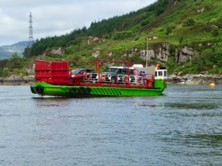
This seemed unchanged since the 1960's!
We were through. Isle Ornsay, my destintion hove into view - but we still had tide and wind in our favour - why stop. Mallaig beckoned.
"A busy industrial port' said the amanack, 'with few facilities for yachtsman". But this was written at least ten years ago. Phone them up. "Ach yes sir" said the harbour master,'we have pontoons now, I'll put you through to the manager."
We was allocated a berth and given the magic code for admissions and we sailed on.
As we approached, we were greeted by three red lights. "Do not enter the port when three red lights show". So we stooged about until a ferrry left and the lights went out. I'd noticed that there were two large (to us) ships stooging about too, so decided to let them get in before me. If I hadn't, I think we'd have been barged out fo the way by ships full of farmed salmon....
Soon we were alongside, twelve hours had elapsed since we left Gariloch. Tomorrow, Tobermory, then Oban, then Balvicar......
* less than 200 metres
** Scoolboy term shwoing that your writer is lapsing into his second childhood ***
*** the Owners Agent would say he's never got out of his first one
**** the emergency channel on the vhf radio
***** the names is not witheld for security reasons, it's just that I can't remember it.....
Tuesday 17 June 2014
Still Motoring - but South this time
Vagabond and I are now at Gairloch (not the one on the Clyde, but the one north of Kyle of Lochalsh), in a busy cafe (for a change) where yachtsmen consult Ipads for a weather forecast, climbers do the same and the coach parties carry on their converstions
 On buoy in Rispond Bay


 The Old Man of Stour


I left my readership* on a buoy in Rispond Bay, wondering if the batteries would survive poor light and no shore power and still be able to charge the ipad, the number navigation system?
When I woke the following morning, the ipad was fully charged and the main batteries still had volts.
We left Rispond Bay in damp fog, and cautiously felt our way out to sea, where the mist cleared and I could see Cape Wrath.  The various books caution the navigator about approaching this cape. There is a small passage, between the Cape and an outlying rock that "should only be taken in calm conditions at slack water". Well, the conditions couldn't get much calmer. 4kn of wind (from the West) and no apparent swell. But it is the time of the spring tide, so the currents are very strong and the water is very disturbed. "Look out for white water in the passage, and if you see it, keep 3 miles off shore" We approached the Cape just as the tide was turning. "let's take the inshore passage", I thought.
The sea was clearly confused and lolopped about. Waves 3 - 4 feet high coming from (it seemed) every direction at quite short intervals. Big holes would appear in the sea where opposing troughs coincided and the tiller worked hard to steer us between the worst.
Approaching Cape Wrath
All calm again
Vagabond staggered through it all for about 30 minutes and then we were round, into calmer seas. There was still no wind, so Freddy drone on to KinLochBervie, where we went alongisde a pontoon. The fishing harbour was quiet - it was the weekend.
The following day (after filling up with petrol) we motored south the Loch Inver, and the day after we did the same to come to Gairloch. I've established (again) that Freddie burns a litre of petrol an hour......
At least on the trip from KLB to Loch Inver we could see the magnifcent mountain scenery, stretching away to the South.
Flat calm off Gairloch
Nature notes
None of real interest.
Not a fin in sight for the whole three days.
The odd Auk or two and a few puffin.
We motored past Handa Island - this used to be the home of a large Gannet colony. Two thirds of the ledges were empty and there were few birds to see.
There was a Skua that kept up with us, in the hope we'd throw out some discards. It would fly past us, low down, a few boat lengths away and land in the water ahead of us.
As we approached, it would take off, and fly close alongside, almost at my eye leve, looking at me meaningfully. It would then wheel away and land astern of us and wait until almost out of site. Then the whole sequence would be repeated. This went on for a couple of hours!
As we motored into Gairloch, a white tailed eagle flapped overhead.
Kyle of Lochalsh tomorrow.
* I know I have a least two, now, as they have been leaving comments! All comments are welcome and will get a reply (depending on internet connectivity)!
Saturday 14 June 2014
Sailing (well, mostly motoring) West
I do hope that my readership was not worrying about not seeing a new posting on this blog for a day or so. It's just that last night we were in a remote area, where 20th Century technology*,let alone modern stuff**, has not yet reached.
You'll remeber that we were alongside a pontoon in Stromness, Orkney: I was planning to leave on the beginning of the outgoing tide on Friday 13th June for a 50 odd mile trip to a place called Loch Eribol, on the North coast of Scotland, as close to Cape Wrath as we could "park" for the night.
This would have meant that we couldn't leave Stromness until about 11:00, when the flow in Hoy sound changed to outward: we would be arriving at the entrance to Loch Eribol until at least 22:00, when it would be getting dark***. The forecast was that it would be over cast, possibly foggy and with little wind. Arriving at somewhere in the gloaming in these conditions didn't seem too great. Perplexed, I went to bed early. I woke at about half past two in the morning to find that my subconcious had been working over time.
Why not go now, the tide will be flowing outward until about 5 o'clock.
So we did. Sandwiches were made in record time, Vagabond was made ready for sea and we were off at about 0430. It was raining and misty. I hoisted a sail, to pretend we were sailing and lit my sailing navigation lights****
Once clear of land, we were immersed in a cocoon of gray, wet mist. and stayed that way until about 10 o'clock, when the sun burnt through it. The forecat Easterly breeze failed to materialise, so Freddie barked onward.
Land loomed to the South, shrouded in low cloud. Dounray, it said on the chart. I didn't think we wanted to go there, so we carried on.
Lunch came and went. Afternnoon coffee went the same way. Radio 4 carried on - explaing what was going on in Iraq, Syria, Afganistan and the Ukraine. It was silenced during the Archers.*****
At last we rounded the headland at the entrance to Loch Eribol and motored into a wall of mist. With the aid of the GPS we found our way into Rispond Bay, a little cleft in the surrounding cliffs, where there is a small (drying) pier and a protected pool with a number of mooring buoys of unknown provenance. I chose the one that looked least decrepit, hooked on and made a cup of tea.
We'd arrived without seeing another boat, any birds and only one solatary seal, that greeted us as we arrived....
Now, would the batteries have enough power stored in them to recharge the Ipad (essential for navigation) and to run for anther day - when we should be rounding Cape Wrath
* Mobile phones
** Wi Fi tobroadband
*** It's the middle of June - getting dark in this north western part of Scotland is a relative term, provided the weather is fine.
**** Vagabond is not fitted with "steaming' navigation lights
***** A long running "every day story of country folk" .......
Thursday 12 June 2014
Scapa Flow - a retrospective
Well, I threatened you with a detailed description of our voyage from Wick to Stromness*
No one from my extensive readership*** has demurred, so here we go:
We cast off from the marina pontoon is Wick at 06:20. I know this because it's still written on the cockpit bulkhead, for I'd intended to keep an accurate log for the trip**** - it's the only entry! My passage plan was written on a series of sketch maps, showing me the tidal stream direction at various places at the times I expected to be at them. These had been translated into a route plan on the back up GPS. The ipad had been charged to within an inch of it's life. I was wearing my blue immersion survival suit and was feeling hot and damp already.*****
At the start, the wind wouldn't behave. It was a set of cats paws from the south. After about half an hour it veered to the West and grew to about 10 knots
We actually reached Ducansby head a little early: the tide was still flow strongly East and South, and I wanted to be there when it was "slack". I knew it was flowing that way, because as we approached the head, a large oil rig thingy ( two storeys on stilts, clearly floating on some sort of barge) suddenly appeared from behind the cliffs and moved majestically but quickly across the gap between the Head and a set of skerries on the far east. It missed the skerries and disappeared o the South East.This gap is about 2 miles wide and this thing crossed it in what seemed to be about 10 minutes.
At this point, I thought it might be prudent to put in the first reef before we left the shelter of the land. Also, heaving to for a bit would let the tide catch up with us.
So, at just on 10:00, on plan, we stuck our nose past Duncansby Head and steered north towards the gap between two island. This was the tricky bit - if we were too slow to cross this gap the resurgent tide flow (this time in the opposite direction) would catch us and sweep us West into the 'Worst tide race in British Water' (according to the various guides) - the dreaded Merry Men of May
At first, there was no increase in wind speed but, rather than hang about whilst I took the reef out, Freddie was pulled into action and we crossed the gap in a just over an hour. By now the wind had risen and Freddie had been shut down and we sailed smoothly with the tide up to Scapa Flow. Here' the wind suddenly increased to about 20 knots, so the second reef was taken. All I could do now, to reduce sail should the wind freshen more, would be to lower the jib. We missed the oil terminal buoys, the rock that occasionally dries and sailed over what's left of the sunken wrecks of the scuttled WW1 German battleships and reached the far side of the Flow. The wind had risen, rather than dropped, so I tried to roll up the jib. This repeated the Liverpool bay trick and, again. I was on the foredeck tying down the sail that I had rather unceremoniously lowered. This excitement had made us drop down wind from Hoy Sound, the channel we needed to take to Stromness, so we were faced with a series of tacks to regain lost ground or the further use of Freddie. We pushed into the wind. The tide was still running in our favour, so we had a strong wind over a quick tidal stream. We were heading into steep waves about three or four feet high. Spray flew over the foredeck and into my face on a regular basis - I hadn't a hand spare to erect the spray hood. At one point we surfed down one wave and buried the bow in the green stuff. Otherwise, we rose up the side of a wave and slammed into a trough. So we slowed down and plugged our way onwards. After an age we reached port, the marina and a hot shower.
By the wonders of computer stuff, I've managed to download the chart plotter ma of our voyage.
The blue bit is the track we actually took and the purple bit is the route that I had planned. Makes it look easy, doesn't it.
* That's the town of this name in Orkney, not the one in South Georgia**
** but I've not been to both
*** I'm probably becoming delusional
**** as all skippers should
***** Despite feeling hot and damp, I have to give it full marks. It kept me reasonably dry (I'd trapped the hood under my life jacket, so took spray down my neck) and it kept me warm.
Wednesday 11 June 2014
Furthest North (?) 58 deg 57.876 min N, 3 deg 17.652 min W
You, the perceptive reader will notice that there has been another day without an edition of this blog. Yesterday, I feared there may not be any more. Not, I rush to assure you, because I thought I had put Vagabond and your writer in any peril * but because I thought that we would have to terminate the expedition. It was all down to tides, the weather, the dreadful North Sea and the Pentland Firth. You have to be at certain points just as the tide changes, to catch periods of relatively still water. Rather than bore you with a detailed description ** of the geography of the are of sea between the Orkney Islands and the mainland, the differences in tidal flows between spring tides and neaps*** suffice it to say that this particular bit of water can be quite tricky to navigate through, with tidal currents that can be as much at 9 knots***** at springs. Spring tides are rapidly approaching and I knew that as soon they were only two or three days away Vagabond would not be able to cope with the current speeds, even with Freddies noisy assistance.
The weather forecast had suggested that yesterday would be a good day to attempt the crossing. Nip up to Duncansby head, from Wick, wait for the lights to change (sorry, I meant tide), sprint across the Pentland firth and up past S Ronaldsay, into and across Scapa Flow into Hoel Sound and - hey presto - we would be at all with the help of a following tide and a SE wind.
Well, it didn't work out like that. Tuesday dawned with lowering clouds and a light Easterly wind. We were late to leave Wick and plodded up the coast, against the tide. The wind fell away, the mist closed in and the rain became torrential. After an hour or so, it dawned on me that we wold not be at the cross roads in time to catch the lights changing. If we didn't turn back soon, our tide would change, pushing us towards the firth at a time when the tides there would take us for an unplanned ride. My dilemma was that if we turned back now, the following day would be the last day before we had to wait about a week for the tides to calm down, and, if we couldn't make the passage to Stromness due poor weather, it would mean that I would be unable to get Vagabond back to Balvicar in time, so the whole circumnavigation would not be completed this year. I could imagine the Owners Agents trenchant remarks......
Sense prevailed and we turned back. Wet through. The sun came out as we rentered Wick Marina
I knew I had bought a Sunday paper for some reason.

Here's a general view of Wick Marina, in the evening sun
Hence my rather black mood yesterday evening. But this morning dawned bright and sunny with the promise of a S Westerly breeze. Overnight I had checked and re checked the plans: leave at 06:30. Be at Duncasby Head by 10:15, rush across to S Ronaldsay by 12:00 and catch the tide northward all the way to Stromness.
Well, we got here. On the way we had winds in excess of 26 knots (true), two reefs were taken in, the jib yet agains refused to roll up and had to be dumped on the deck (reminding me of the trip to the Isle of Man), the rip tides, disturbed water and overfalls were the worst I have encountered. We even encountered TRAFFIC (this was the first time since the Caledonian canal).
I'll tell you the more detailed story of it tomorrow, if you're interested. Noting else is going to happen tomorrow, the forecast is still for 23 kno winds, and I had enough of those today!
Notes and asides:
* well, no more than usual, that is.
** imagine a cross roads in the sea between a big island (the mainland) and a groups of much smaller islands. On the West and to the north of the cross roads is a very big ocean (the Atlantic) and on the East and on the South is a much smaller sea (the North Sea). Gravity (those as yet undetected but theoretical waves) from the sun, moon and earth combine to make the sea water move in a bulge round the earth. This causes currents that are amplified when the water tries to squeeze through the cross roads. Tide heights are bigger during spring tide (which happen roughly every two weeks, so the tidal currents not only go through a rythym from high to low tide, but also go through a rythym from weaker tides at neaps (see ***) to stronger tides at springs. Ifa boat arrive at the cross roads at the wrong time, it can be whisked into next Sunday before the captain can say "Jack Sparrow".
(phew, I bet you enjoyed that).
*** nothing to do with Haggis, I can assure you.****
**** Bad in joke for readers with some knowledge of Scottish cuisine
***** 1 kn (or knot) is a speed of 1 sea mile per hour
Monday 9 June 2014
Helmsdale.......
Now, I hope you are waiting on my every word, to find out about the voyage from Inverness to Helmsdale. Before I start on the details (which could be the beginnings of one of those 'I learned from that' episodes in some of the popular boating magazines), let me describe the scene in front of me.
I'm sitting in a Wetherspoons pub in Wick having coffee - this chain has got here but I can't find a Costa - at about 11:30, having looked up the weather for tomorrow. In front of me is a large 60 yr old chap just downing a double whisky chaser.....
But I digress. Let me take you back to Inverness marina at 07:00 last Saturday. Had you been standing on the quay side, you would have seen Vagabond depart and head NE under the Kessok bridge, with Freddie barking with delight. There was a light breeze from the NE and the forecast was that it would veer round to the South East during the day, strengthening at about midday to F5 (possibly 6) and then dying down to F3 by the early evening.
I had two destinations in mind - Cromarty, about 15 miles NE of Inverness, or, possibly, Helmsdale, a further 25 miles to the NE.
The wind remained light and we motored the six miles up the firth into the wind and passed through the narrows, where we could alter course a bit to the north, so the sails were hoisted and we motorsailed on. We were doing so well that we came up to Cromarty by about 10:30. The sun was shining, the wind had turned to the East and Freddy had been turned off - it seemed too good a day to waste, so Cromarty was passed and we headed up the coast.
Cromarty Entrance:

As we passed Tarbet head at around midday, the wind strengthened (as forecast) but stayed resolutely in the East. We were now beyond the protection of the Murray shire coast and the waves began to increase. As did the wind. The foresail was rolled up. The first reef was taken. The second reef was taken as the wind gusted to 22 knots (true).
'It'll be OK' I thought 'the forecast is for it to drop'
We still had about 20 miles to go. White horses appeared as the waves mounted, running at about 40 degrees to our course. (Our course was about 055, close hauled*, so the waves were running at about 095). The bow would rise and we'd roll to port. The bow would reach the crest and we'd be through and roll to starboard, slumping into the trough. Then the waves began to show streaks of foam, running downwind. I eased off the main a bit but we were still tramping along at about 5 and half knots.
I suppose the waves were about 4 to 5 feet from trough to crest, but seemed much higher. Every now and again we'd rise to a crest just as it decided to break. So we'd have spume and more into the cockpit. I was soaked through and realised that I should have put my blue survival suit on some time ago.
I turned into the wind and, whilst everything thrashed about, struggled into the suit. Feeling dryish (apart from my wet pants) and more snug, we resumed course.
The sun shone but the wind stayed resolutely in the East and showed little sign of abating.
The Ipad told me it was running out of battery and shut down. So I'm now down to one means of navigation.
The Garmin told me it had lost position and reverted to motoring mode. Now we had no means of navigation apart from a compass and a rough sketch map I had made of Helmsdale approaches. I took the battery out of the Garmin, removed and replaced the memory card that contained the chart data and, with fingers crossed, restarted the thing...
It cheerly welcomed me, told me it had found the charts and that all was well and that we were on course (we were,actually).
By about 6 o'clock, Helsdale hove into view. The Clyde cruising club guide says that the entrance to Helmsdale is DANGEROUS in strong easterly winds; if a red light showed on the harbour wall the harbour was closed. I began to wonder how much longer it would take us to get to Wick, shou we find the light red.
Finally, we were close enough to see the leading marks, and there was no sign of a red ight, just waves crashing against the harbour wall. Freddy eventually was pulled into life, the sail was dropped into the lazy jacks** and, for once, the reefing lines didn't try to garrotte me *** and we follwed the marks into the harbour entrance.
Once past the wall, there was a hard turn to starboard and we were into the comparative peace of the harbour. I took the last space on the pontoon and realised I was in for a bumpy night.
A plate of scampi and a pint of Abbots Finger (brewed in Faversham, in Kent) in the Bannockburn Arms restored my peace of mind and by 21:00 I was in my jim jams and sleeping bag, just in time for the heaven to open as rained stair rods. The wind finally read part of the forcecast in the early morning, when it dropped to a gentle (but still easterly) breeze.
* Close hauled means we were sailing as close as we could to the direction of the wind. Anything between 40 to 60 degrees off it, depending on the type of boat.....
** Lazyjacks are pieces of sail cloth that hand off the boom and catch the mainsail as it's lowered. Without them, the person standing underneath the sail gets smothered in wet sails.
*** One of the benefits of sailing with a reef or tow in, means that the reefing lines are pulled tight to control the size of the sail, so there's no slack to fall over you when the sail is lowered. The reefing lines run outside of the lazy jacks (but I wonder if I can change that).
Sunday 8 June 2014
Wicked
Just in case it's not been a mistake and you are still interested in our progress, Vagabond and I arrived in Wick harbour (the inner basin) at about 17:32 today (Sunday) after an 8 hour (30mile) passage from Helmsdale. Compared with the passage from Inverness, it was quite uneventful, periods of no wind interspersed with periods of Southerly winds of up tt an estimated F4. * The set of the waves was uncomfortable at first, still calming down after the previous days' exertions, but eventually all was relatively calm as we sailed, or motored along on, following the coast on our course of about 050.
The sun shone, the threatened rain kept off. I could see it moving up the coast astern of us but (to quote the bbc weathreforecasts) 'it petered out' before it reached us. Oil (or gas?) rigs slid past on the easterly horizon. The minland basked in the sun, sparklingly clean after the heavy overnight rain. Squadrons of puffin flew urgently across our course, either out to find fish or inward to unload it on their young. Young birds sat on the sea, waiting for food; they either swam away or dived to safety as we approached. Total other vessels seen in the day - 3**. No of castles perched on imposing cliff tops - 2.
Eventually, we passed a headland and turned due north. Then Wick bay hove into view, the appropriate buoys and leading marks were identifed and we pottered into harbour.
But, I hear you ask, what happened yesterday? All will be revealed in the next installment of this thilling periodical.........
Meanwhile, here are some photos I took today:


Yachts that pass

Entrance to Wick
* Force 4 on the Beaufort scale. Check it out on Wikepedia, I think it means about 15 miles an hour
** This is either a comment on the amount of traffic or the efficiency of the lookout.
Friday 6 June 2014
Starting again and more silver ware!
I arrived back in Inverness yesterday evening to find that the weather had not been reading the same forecast as I had. Expecting light easterly winds, I found a NE force 4, accompanied by mist and drizzle. Not very auspicious start to the next leg of our wanderings, up the NE coast of Scotland to Wick, through the legendary Pentland Firth and on to Cape Wrath and then south down the wonderful Western Isles.

I wandered into the Marina office this morning to get the weather forecast and, to my surprise, found they had a package for me, left by Norna, the stalwart "team secretary" of Sail Caledonia. On opening it, I found we had been presented with a "wee* cup", inscribed "Winner, class 5". I felt a bit humble, considering that out of all the races, we had 2 "did not starts" awarded and a similar number of "dnf" ** situations.
Anyway, here's a photo of the wee cup on the cabin table.
* Scots for small, tiny
** Did not finish
Wednesday 4 June 2014
A video clip.
One of the benefits of sailing with other boats is that you and your boat may appear in a photo or two. In this case, Vagabond appears in a clip clip which youcan find at:
http://m.youtube.com/watch?feature=youtu.be&v=IXkXftlr30o
So sorry, you'll have to copy the url and paste it into your browser as I can't work out how to make it work as a link!
The clip was taken by Johnathan Stuart from the Bay Raider Psalter, whlist we were engaged in a tacking duel on Loch Ness.
Vagabond and I renew our solo voyage on Saturday - north from Inverness towards Wick. Keep following!
Subscribe to:
Posts (Atom)