Saturday 28 July 2012

Fishguard and Cardigan


05:30. I've been awake for an hour. The forecast is now mist and fog, some rain, no wind. The visibility at the moment is fine, I can see Ramsay Island and passage bout 6 miles way to the North West.
On goes Freddie, up comes the anchor and we're off.

As we approach the Sound, the mist closes in. I can see the rocks that mark the beginning of the passage, can see the ones in the middle that we are to miss but can't see the ones at the far end that we are meant to line up on the get through the passage unscathed. The tide is turning and starting to push northwards.
I resort to a bit of instrument flying. The GPS on my IPAD shows a heading line for the boat eg the way the wind sea and Freddie are pushing us, irrespective of the way the boat is pointing. With heart in mouth, I line up this heading line with the "recommended" course line on the electronic chart.

We're committed.

Twenty minutes later we're through, having seen very little of the Sound. Visibility now gets worse, no more that 50 - 100 metres. I reduce speed to a slow crawl.


A gull, flying without the benefit of instruments, sees us at almost the last minute and catches it's wing on the forestay. It flutters off, no doubt wondering where we had come from.

Visibility improved after about an hour and we were able to continue up the coast of Pembrokeshire at a slightly increased speed but it was now obvious that we would not arrive at Cardigan in time to catch the tide into the river estuary.

I phone the Estate Agent. He wants to get our sale in his month's figures. We have a bargaining session and he agrees to go back to the Vendor. I phone the Owners Agent to tel her the news. He phones me back. We may have a deal.

I go silent as we enter Fishguard, narrowly avoiding (thanks to the AIS warning on the real GPS) a ferry bound for Ireland. I anchor in the pool at Lower Fishguard and phone the agent to get the deal finalised. The vendor now requires a new mortgage arrangement. Will it never be over?

Doris the dinghy is inflated and we go ashore. There's one pub in Lower Fishguard and it's shut. The sailing club is shut until 7pm.


Welsh weather.

Next morning we leave Fishguard, again in no wind and little visibility and Freddie pushes us up to the Teifi estuary at Cardigan. Here's where Swallow boats are based and I've arranged to use their mooring for a week or so. It's nerve wracking getting in - the estuary is shallow and there's a very narrow channel round the bar and into the estuary. Even more so than the instrument trip through the Ramsay Sound. We touch bottom twice before finding the mooring. Fortunately, we went in on a rising tide.......


Leaving Fishguard

Leaving Vagabond secure, under the watchful eye of Charlotte of Swallow boats, I make my way back to Bucks by three trains and two buses to find a Sale Agreed sign outside the house.

By the way, my old persons bus pass doesn't work in Wales - it's a separate country look you.


Skomer Island

We had reached Milford Haven on Sunday evening. I needed a rest after an exciting passage from Lundy and Vagabond needed a good clean. This is not because the Purser and I had made a mess in the cabin, it was because the sand and mud brought aboard from the mooring ropes at Ilfracombe had got everywhere on deck and below.

The Plank (turn your PC on one side!)

There were also the chores that occur through wear and tear. Some rope ends needed whipping and I needed to find somewhere on deck to stow the fender plank,  which is placed outside of the fenders when the dock wall is somewhat irregular. It was used to good effect when alongside the wall in Padstow and again alongside the waiting pontoon here. It was now thoroughly dirty and could no longer be stowed in the cabin.
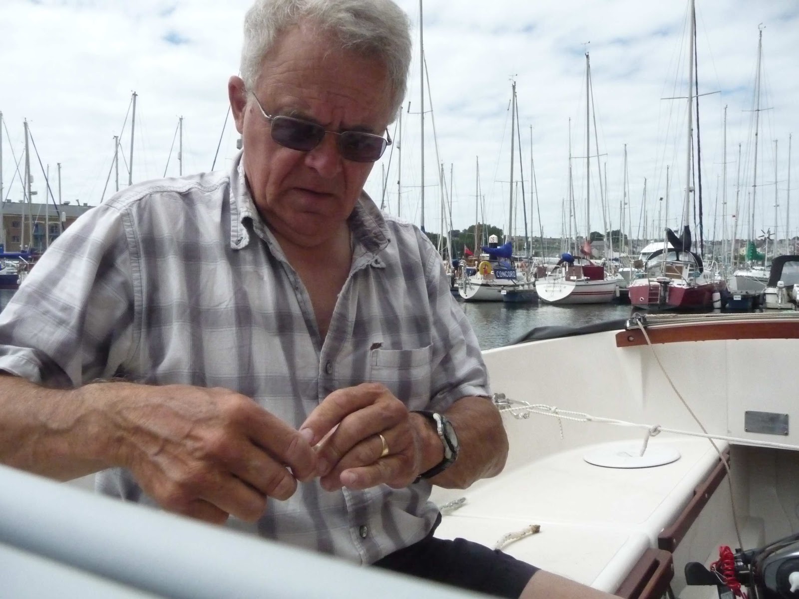
Make do and mend
So we had a day of “make do and mend” and they used to say in Nelson’s Navy.
Inevitably, you get interrupted when doing such stuff about the boat. People want to stop and talk, to say how pretty she is (even with 2 months worth of grime on her decks) and find out what sort of boat she is and what I’m doing with her. I really need an advert for the blog that I can hang from the boom when in port (or some business cards to hand out!).
The discussion then turns to where to go next. Several boats were aiming for Ireland. No one was going north. In fact there was no -one who had....
I mention Skomer and Ramsay islands. Other skippers shake their head – ‘It means going through Jacks’ Passage and then Ramsay sound. Lovely when you get to Skomer but you have to be careful. Mind you, the Puffins are fun....”
The weather forecast for  the next day (Tuesday 24th July) - by all three weather forecasts  that I follow – suggested F3-4 from the South in the morning,  dropping over night and then 3 4 from the South  or variable for the following day. Sounded just right for Skomer and beyoond. 
Skomer it was tomorrow.
I read two Pilot books about Jack’ passage.
DONT GO THROUGH AT ANYTHING OTHER THAN NEAPS. (We were half way between springs and neaps. )ONLY go through at slack water – the two Pilot books differed as to when slack water occurred.......
From my point of view I wanted to go through as the tide turned from running south to running north. This was because of a complicated tidal current situation in the estuary itself.
‘Leave at 12:50’, I said, and booked the lock accordingly and went off to read my emails. One was from the Estate Agent. The possible purchaser of our house had now read his survey report and over a dozen questions as a result. I put my creative writing hat on to compose a suitable reply to them all.  ‘Yes, the bottled gas system had been installed by a competent engineer in 1973. No, I didn’t have a gas safety certificate.’  Etc etc
Next morning, the wind was as forecast. I was just casting off to go to the lock when the Estate Agent called. ‘The purchasor has more questions’. “’Sorry, Gary, he’ll have to wait, I’ve a lock to catch and I’ll then be a bit busy for the next 5 hours.’

Dale - on the way out of Milford Haven

Out of the lock, into the estuary. Up go the sails and we run down river with the wind on our beam. The water is smooth and we romp along, overtaking a couple of large boats in the process.  Now there’s a first! We had to tack a couple of times to get out of the mouth, past the inlet of Dale at the mouth and then the tide turned.


Now  we are making scant progress towards our destination.  Freddie springs into life and pushes us along.
There’s a boat between us and the shore  who seems to be making better progress, so I tur in to follow a mile or so astern of him.
 It was a glorious sunny afternoon with vibrant colour and excellent visibility: in fact at one point I looked West and could clearly see what seemed to be an island in the far distance.  Yet there was nothing on the chart in that direction between us and the Southern tip of Ireland 50 or so miles away.  Perhaps going to Ireland was not so silly after all. Fortunately, I hadn’t taken my passport, so sense prevailed and we ran along the western end of the south coast of Wales.
Despite the tide, with Freddies help  there was a real likelihood that we’ll arrive at Jack’s passage too early.
To the right of us lies a wide sandy bay  – ‘Anchorage’  it said on my chart. It’s not in the Almanac or in Cumberlidges guide to the Bristol Channel but ‘We could pop in there and anchor for a bit, until the time was right’ I thought.

 The skipper of boat in front thought so too as he turned and went in. His dinghy went off with the dog. I went in too, anchored some way away and started to read the paper.
 I was awoken by the sound of his engine and looked up to see him well under way and moving towards the passage. 

Overfalls

Up came the anchor in double quick time and we rushed off to follow him. He  had clearly been through the passage several times before. Instead of dashing straight through, he snuggled up to one rock and then went through at angle to the apparent channel. I copied and was glad that to have done so for the overfalls on the direct route (despite the “slack tide”) looked pretty nasty.

We were through the narrows and turned left (sorry, to Port) to run along North side of the island to the inlet where we could park for the night.  We nosed our way in and the guy in front took the last visitors buoy, so we were in for another bouncy and noisy night on the end of the anchor chain.

Through!

Whilst cruising looking for a suitable, shallow and protected spot to anchor , there was a thump from the centre board. I had hit a rock. It was marked on the chart, so at least I knew where I was....

That panic over, we settled for the night and a sat and watched puffin (some desperate to get out to sea to get fish, others staggering home overladen and anxious to find their burrows and young)  until the light was too poor to see. Several attempts to capture these as bits and bytes proved that I am not a wildlife photographer.....
Approaching Skomer Island, Jacks passage on the right
Tomorrow, it’s on 05:30 start for Ramsay sound and then on to Fishguard, as we cross St Brides Bay and move into Cardigan Bay. ST BRIDES BAY CAN BE A TRAP IN WESTERLIES says the Pilot sternly. ONLY PASS THROUGH RAMSAY SOUND IN CALM CONDITIONS, AT SLACK WATER ON NEAPS AND IN GOOD VISIBILIY.
The forecast is calm and misty. We're a couple of days before Neap tides.....


Thursday 26 July 2012

Lundy Island and on to Milford Haven


Some 40 years ago, an advert in the London Times for the position of Warden of Lundy Island. The position required someone who was good in small boats and could manage people. I almost applied: the Owners Agent advised against it and I had always had a secret ambition to visit it one day. Well, that box can be ticked and I’m glad I didn’t apply.  It’s a lovely spot for a day but I could not imagine living on it!
Back to Vagabond. The Purser and I had found our way in to Ilfracombe and moored fore and aft to lines attached one of the visitors buoys. We went ashore, found the local yacht club and had a free shower before wandering round the town to find somewhere to eat that provided free Internet access on the side.
The Purser had to return home the following day and we need to find bus and train times to get him home via Barnstaple (Bus), Exeter and Reading (train).
Vagabond settled on the sandy harbour bottom and we had a peaceful night sleeping above the current local sea level. Next morning the water returned and I rowed the Purser ashore to catch his bus and then readied for sea. I was reluctantly aiming at Swansea – it was really too far East and would take me even further into the maw of the Bristol Channel and it’s fearsome tidal currents and tidal range. Even at Ilfracombe at “springs” (and it is springs*) the range is 7 metres **.

Drying out in Infracombe

By the time I was ready, the water in the harbour was receding fast. I cast off and immediately ran aground. Quickly raising the centre board broke the connection with the bottom:  I had left it too late to leave.
I returned to the mooring and spent the day doing “stuff” on Vagabond and generally drying out.  It was sunny and hot, the first sunny day ashore for some time.  I repaired to the yacht club and got into discussions with some locals.
‘The weather looks settled, it would be a good time to go to Lundy’ said the commodore ‘Several of our members are leaving at 08:30 tomorrow. Why not come?’
It seemed a good idea – Lundy was in the right direction for Milford Haven. ‘Can I anchor there overnight?’ I asked. ‘Yes – mine’s a pint’ was the answer.
And so it was that I joined the fleet aiming at Lundy the following morning. There was no wind, so Freddie was pushing us all the way. The fleet left us behind and their Penta diesels powered them ahead at 7 knots.


Leaving Devon behind

 We left Devon behind.

By the time we got to Lundy the visitors buoys had all been taken. We had to use theanchor. Help. It’s only a little thing with 5 metres of light weight chain on it. And the tides – I need almost all the rope and chain I’ve got to cope with the rise in height of the tide!
I anchored in about 4 metres of water, let out all the chain and most of the rope and then slid one of my weights down the rope to the bottom to provide an additional resistance.

I worked out my courses to Milford Haven for the morning, checked the weather forecast (F4 – 5 from the South, ideal) and abandoned  Vagabond for the afternoon as I joined the day trippers walking around the island.
I climbed the light house, had tea at the Inn, walked some of the cliffs and heard rather than saw the sea birds. The Island is owned by the National Trust*** and consist of a flat plateau, about 200 feet * above ea level, with cliffs all round. There is a church, a farm house and a few barns that have been converted to visitor accommodation. Pigs were in a pen, sheep wandered around and still the grass was being cut by a machine. And, as it is owned by the NT, there is an NT shop!

Local pork sausages were on the menu board for the evening meal.
I took a few photos. They were all rubbish, so you can't see them except for one of the fleet moored in anhorage off Lundy.


The fleet in the anchorage at Lundy
I returned to Vagabond, cooked my meal and prepared for the night.
It was uncomfortable – a swell came in from the North and Vagabond rolled heavily and various lines inside the mast rattled and clanged to the rythym of the waves.
Not a good preparation for a 10 hour sail to Milford Haven.

Despite this, when I raised the anchor to set sail next day we were still in the same position as the previous evening, so the little anchor may not be so bad after all.


At 05:30, we motored out from under the lee of Lundy Island, to be met by a southerly breeze. All sail was hoisted and we were off skipping along on a course that was just north of north west, aiming at Milford Haven.

Soon small wavecrests started to break and Vagabond was become less docile. Time to take in a reef.


Docility was restored. An hour later, larger waves were starting to break and the process was repeated.


So we flew along, with the tide (and Lundy) behind us. I could ust discern a stick on the horizon ahead and wondered what is was. Half an hour later it became clear that the stick was part of the petrol refining complex at Milford.


We came up to Milford Haven entrance. By now the tide had turned, pushing us  away from the land. It took ages get into the mouth of the Haven but, once in, the water calmed down and we had a good sail up to the Milford Haven Marina. This was rather spoilt as I had to wait for an hour on a rather rough pontoon for the lock gates to open to let us in. We weren't alongside and properly moored up until about 7:30 pm.
14 hours.
I was shattered.
And, of course, it was Sunday. In Wales.
Nothing was open.


*  Anyone know why the high tides that occur every two weeks are called spring tides?
For non metric readers
** Roughly 22 feet.


*** An English non governmental organisation that owns most of the English “heritage” sites. Go and look it up in Wikipedia ; -there’s bound to be an entry.

Monday 23 July 2012

Westward Ho! and Ilfracombe

This morning (23rd July) I received a complaint. The elder sister expressed dissatisfaction; the blog was not up to date. My defence was that I didn’t think my reader(s?) wanted to know that the Purser and I had spent three days in Padstow waiting for a weather window in which we could dash up the forbidding North Cornwall coast to the safe haven of Ilfracombe and that since then he and I had been too busy to write anything. I believe she may have allowed ne this licence and I hope you (dear reader) will do so too.
I left you and Vagabond in Padstow harbour, moored alongside a larger yacht, whilst I went home to house hunt (possible success but am I ready to move into a setlement for the over 55's?), cut the grass, and take more stuff to the waste disposal site. It amazes me what I have acquired in 38 years whilst living in the same house....
I returned to Vagabond, with the Purser on a full First Great Western train (standing passengers all the way from Reading to Exeter) a week ago expecting to sail on the following day. The weather had other things in mind and we had to wait until the following Thursday for the wind to abate.
Now, Padstow is a lovely town that is overrun by visitors. Fortunately (from my point of view) the current economic climate means  they do not stay out in the bars that surround the harbour until all hours. For the traders it’s another matter.  ‘There’s not so many of them as usual, and they are keeping their hands in their pockets’ was a common refrain from the traders. The town band played on.
Alongside the wall
The famous local fish and chip shop was doing a roaring trade; queue to get in, seat at refectory style tables to eat well cooked, delicious fish and chips.
In between rain showers, we walked on the Rock peninsula, went to the church where John Betjeman is buried and strode out along the Camel trail (river, not ship of the desert) whilst the wind blew over the hill tops.

The Camel Estuary at high water

We returned from one our walks to find that our "buffer boat" had gone and we were now alongside the harbour wall. My weights were deployed to allow the lines to remain taught whilst the water level changed in the harbour, because Padstow, like Penzance, has a single gate across the entrance. This keeps the water in the harbour when the tide goes out and it opened for about 90 minutes either side of high water, during which the water level fluctuates with the tide. It also means that you are restricted to leaving during the open times.
We wanted to go to  Ilfracombe, further up the Bristol Channel from Padstow, so really needed a rising tide to carry us along. We wouldn’t get that until at least seven hours after the gate opened but as it would take about 12 hours to get there, we would at least have a few hours when the tide was with us.

On Wednesday evening,  the forecast suggest that the wind was calming down, Force 4 -5 from the South West. Sea state rough and going to moderate (2 metre waves*) later.

“We’ll go!” I said. “Tomorrow,  after the harbour gate has been open for an hour. It means we leave at 07:30”.

The 05:30 forecast was unchanged. We left. The outgoing tide carried us down the Camel estuary and round the bar. We hoisted the sails turned  North.  By now, the ebbing ride was rushing south, so on came Freddy. The forbidding North coast of Cornwall slide by. Bude. Tintagel.  There are no practical "ports of refuge" along this bit. The sea was very broken and disturbed, with large waves coming at us almost randomly. Keeping the boat on course and us dry was hard work.
We pressed on and eventually passed Hartland Point. Bideford Bay opened ahead of us. Now we had two possible ports of respite – Clovelly, which is very small and dries, or Appledore, which has a difficult entrance. After a brief discussion I decided that we would push on to Ilfracombe. We should be there by early evening.

The tide turned and was now in our favour. Off went Freddie and we swept long at more than 7 knots.  Dolphin appeared and played with us for 10 minutes or so. The sea state changed: gone was the randomness, now  3 metre** swells came in from the South West, lifting our stern whilst pointing the bow down towards the preceding trough. We rose up and had a wonderful view of the surfing beaches as we ploughed on. The wave would pass and we would drop stern first into the trough so that all we could see were walls of water on either side.
We surged past the surfing beaches, Westward Ho, Croid Bay and  Woolacombe Bay
Ahead was Bull Point. We intended to keep close into the point and then turn right to run down to Ilfracombe. Almost at the last minute the Purser spotted some breaking waves. ‘Growlers’ he said and turned away from the land. This took us into very rough water caused by the tide rushing past the point and Freddie had to be awoken to push us towards the coast, away from them.
We were now looking for Ilfracombe. If a small boat hadn’t chosen the right moment to leave port, I think we would still be looking. T e entrance is very narrow and opens into a small outer and slightly bigger inner harbour. Both of these dry out completely at Spring Tides...

It was now a couple of hours before high water again, as it had taken us 10 hours to come up from Padstow. We found a bouy in the outer harbour and hooked on whilst I went to explore the inner harbour in the dinghy. There were bouys available there too. We slipped and moved cautiously into the inner harbour and picked up a visitors buoy.  This had two slimy and very sandy ropes attached. One was secured to the bow and the other to the stern. We lifted the centre board, raised the rudder and went ashore where the local yacht club provided us with a welcome shower.
Vagabond eventually settled quietly on the bottom at about 10;30 pm and we had an undisturbed night. Next day, the Purser caught a bus to go home and I did a few jobs to take care of Vagabond before repairing to the yacht club for some advice on the next stages of my trip.
The weather seemed just right to go to Lundy.


I expect I’ll now get complaints because there are no pictures in this episode. We were too busy!


For the benefit of transatlantic readers
* 6 feet 8 inches
** 10 feet

Thursday 12 July 2012

Rick Stein town (Padstow)

Once Vagabond was afloat in St Ives harbour on Monday mooring, I had to bustle to and get organised, or we’d be staying here another night. Off ashore again to by some food for the passage (and read the paper and have real coffee).  I washed in the public loos (there didn’t seem to be any for yachties) and then visited the harbour master to pay my dues – £20, which I thought a bit steep for one night with little in the way of facilities. I discussed with him my plan to leave by about midday. He reckoned I should leave earlier to avoid being let high and dry again. The depth sounder on Vagabond confirmed that the water was already receding. It was down to just over a metre by the time the dinghy had been deflated and lashed to the foredeck, the sandwiches had been made and the route to Padstow checked for the umpteenth time.
As we cleared the harbour and hoisted the sails the mist and rain closed in; we had a miserable slow sail fighting the tide for a couple of hours. At times there were no visual references at all, not even a glimmer in the sky where the sun was. Steering by compass in the light wind took immense concentration.
Suddenly, a cardinal mark emerged through the gloom. We had barely gone 4 miles. This won’t do, it will be low tide again by the time we get to Padstow and we won’t be able to get into the harbour., because it’s protected by a single gate (like at Penzance). Freddie began barking away (it’s not that loud but it is only about 3 feet way*!) as we motor sailed at about 5 kn with the light wind on our port quarter.
The sun came out behind us and it became possible to keep course by “reverse” bearings on the St Ives as it slowing receded behind us. Gradually, the visibility ahead improved and then the light house marking the turning point to Padstow shone brightly in the sun. It seemed quite close but it was about 15 miles away! The secret was that it was built 75** metres up the cliff
 There was a loud snort and splash from off the port side. I looked round and saw the clear pattern of a dolphin “splash”. I held my breath. The tiller kicked as something prodded the rudder. Suddenly we had half a dozen dolphin charging along with us, criss-crossing our course, emerging to blow close to either side of our bows.
Of course, the camera was below.
By the time I had fetched it, they were gone.
The wind shifted to the West (not what was forecast) and the tide slackened. Freddie was shut down and we sailed merrily along at 5 kn.
We were accompanied by Dolphin three more times on the trip. At one point a pair discovered us and were happily playing when suddenly there were dolphin converging on us from all points of the compass.
 We were now being rushed along by wind and tide, towards Trevose Head and it’s light house. Here there is a group of rocks off shore. The chart showed the passage between them and the shore  to be clear of nasty pointy things so I had originally planned to go between them and the shore. As we neared the group, I could see white water in the gap, so turned rapidly to windward to clear them to seaward.
We did.
Once beyond this “choke point” we had to turn Eastward to cross Padstow Bay and then turn SE into  the Camel Estuary and the harbour. Of course the wind was dead astern, a point of sailing that neither I nor Vagabond like. Running “off” to port put us towards one group of rocks (ably assisted by the admittedly slackening tide). To starboard pointed us at a cliff. A flight of Puffin whizzed past with  that incredibly busy flying motion t they have made their own.  It always amazes me that they remain airborne at all. 

After a couple of “quick time” gybes we were able to turn into the Estuary and find our way all the channel past the various sand banks and the dreaded “bar”. The Pilot but books are quite doom laden about the bar (it’s actually called the Doom bar) but we found our way along a well marked channel up to the harbour entrance without much trouble.  The wind was now coming to us over a headland – I noticed a scent of the wheat growing on the hillside and, as we came into view of the harbour, a strong smell of frying fish!
We found the harbour entrance gate shut – we were too early so Freddie needn't have been quite so noisy. Never mind, up came  the centre board and we crept towards the outer harbour wall.  We tied up to a ladder and had a cup of tea whilst waiting for the moon and sun to bring the  water to us.
By seven thirty, the harbour gate had opened and we were able to go into the inner harbour. Here we were directed to raft (snugly?) against a forty footer, the deck of which was at least a foot above us, with guard rails to boot!  The Quayside was crowded with holiday makers, all in shorts and tee shirts; they were clearly pretending it was summer. I was just comfortable in a vest, pullover and foul weather top.  And I was knackered: going anywhere on the morrow was out of the question.
A shower, followed by a large glass of red wine proved enough for the night. I was out like a light until about six o’clock the following morning, when I was woken by the council contractor emptying the rubbish bin on the adjacent quay side.  It wasn't raining.
I took the opportunity to open the fore hatch to get fresh air throughout the boat. I found the laundry. Putting the machines to work I settled down to look at the next stages of the journey.
It's now a question of going north up one of the most forbidding coastline in Britain: North Cornwall. There's nowhere really between Padstow and Clovelly that is a haven except in fine, settled weather. After that there's Appledore and then Ilfracombe, followed by a short hop across the Bristol Channel to Swansea.
The forecast said Westerly, F5 today and going to F6 tomorrow. Not fine, not settled. Undaunted, I phoned the harbourmaster at Bude, it's about half way between Padstow and Clovelly to find out what conditions were like "I can see lots of surf" was all he said.
I also had a look at the tide times. If I didn't go tomorrow (Wednesday), the times of high tide were such that I'd either be leaving in the dark, or arriving in it. I didn't relish either.
It seemed that the best thing to do would be to persuade the Purser to join me early next week and make the 50+ mile hop to Ilfracombe in one go, leaving at high tide from Padstow and arriving at the next high tide at Ilfracombe, weather permitting. The forecasts suggest a period of westerlies, so it seemed feasible. I was on the phone to the Purser, persuading him to join me. To my surprise he accepted, so it's off for a period of R & R gardening, decluttering and house hunting in Buckinghamshire until Sunday.


*For the metrically inclined 0.9 metres (roughly)
** For imperial and US metrologists – about 246 feet

Going North at last

Since the last edition of this blog we have seen a few firsts for Vagabond
We have turned north round Lands End
Vagabond has settled on the bottom at low water
The dinghy has been used and now resides in an untidy heap on the foredeck
We have been accompanied by Dolphin and a seal
We’ve sailed in a stiff breeze in fog
The sun has come out.
There, that’s the executive summary of this and the next episode. Very busy readers can go and do more important stuff. For the rest of you, please read on!

We cast off from our raft of boats in Penzance harbour last Sunday (12th July) at about nine o’clock. It was too early to start the trip round Lands End if we were to get the tides right, but if we hadn’t left, we’d have been locked by the “gate” in until the next high water.

Manacles Warning

We found a buoy in the bay and settled down in the unaccustomed sun to a second breakfast, finally leaving at just after ten. The wind was northerly in Penzance Bay, so we had it and the tide on our stern as we wafted past the Manacles (what a lovely name for a group of rocks) and then past Mousehole. 
Mousehole
At the next headland we turned a bit towards the South West and the wind veered to be on “the nose” as we shaped course for the Runnel Stone, the “entrance” to the passage round Lands End.
Our arrival time at the Runnel Stone was critical: if we were too late, we missed favourable tide to St Ives. On came Freddie. Visibility deteriorated to less than a mile. We could just see the shore line away to starboard. AIS warnings gave me the hint that there were a fishing boats about. Suddenly, without any warning, a rowing boat, with a solitary man with rod and line, appeared out of the mist, almost dead ahead.

Lantern Cove
We failed to hit each other.
We motored past lantern cove (I wonder the entomology of that name)  and then the Runnel Stone, or rather the Buoy marking it,  emerged from the mist. We could now turn to the North, to aim at the Longships Rocks; well, not actually at them, but I work on the basis that provided you can see them you then know where they (and you)  are!


Freddie went quiet and the sails and tide did their stuff. We were no longer drifting but chuckling along at more than 6 kn.   Visibility improved as the Longships came into view.
We rounded the lighthouse at the end of Longships rocks and the mists at sea dispersed. We were sailing in a sea that was dark blue ahead and slate grey behind. The North West Coast of Cornwall edged past, still occasionally wreathed in mist, showing the industrial history on the skyline of the cliff. Chimneys of the furnaces that raised the steam to power those beam engines of Trevithick. Horizontal cave mouths in the cliffs that once had discharged the water pumped by those engines.

Longships

Industrial past on the cliffs in the mists

The wind stayed in the West for the rest of the trip. With the tide in our favour, we rounded the last point to take us into St Ives bay ahead of schedule (a first!).  We were too early – the harbour was still a sandy beach, with children playing on it and local boats resting on it. We found a buoy in the “offing” and contemplated staying there for the night. Despite arriving early, the log showed that we had averaged just under 4kn for 34 miles.
Rolling on the buoy outside St Ives
However, it was too uncomfortable so, as soon as the tide had risen and the beach had become a harbour, up came the centre board and  I took Vagabond in, whilst keeping a wary eye on the depth.  We were greeted by the harbour seal as we looked for the expected visitors “drying” moorings – by the Woolworths building, as the pilot book so helpfully told us.
That shop is long gone but there were a number of small buoys bobbing about. Each of these proved to be attached by a light line to large slimy mooring rope that I assumed was anchored to something on the bottom. I hauled one aboard and secured it to post the sampson post on the foredeck. Now we had to lift the rudder and centre board then pump up the dinghy so we  go ashore to forage for supper.
My calculations suggested Vagabond would “take to the ground” at about 2 o’clock, so I went to
bed about ten, fully prepared to have to do something drastic at 2. You would think that this would have prevented me from sleeping.....
I was woken from a deep sleep at 2 by the sound o wavelets breaking and a couple of slight bumps. Then all was quiet and still.  I went back to sleep, to be woken at about 7 o’clock by the sound of the breaking wavelets as the water returned. It was time to be up and busy; ready to leave before the water disappeared again.

Saturday 7 July 2012

Furthest South: 49 o 54.241’ N 005 o 22.307 ‘ W


Barring major upsets, Vagabond achieved the furthest point South in this wander around Britain at 13:01 yesterday (6th July). Not quite up to the acheivements of Earnest Shackleton (one of my boyhood heroes) so we didn’t hold any ceremony at the time; besdies which we were both too busy tacking.
I cast off from Falmouth at about half past eight in the morning, in drizzle. The forecast was for a northerly wind to “back” (a technical term, meaning to change direction as if going round the compass anti clockwise) towards the South West at around midday. Oh yes, rain was included too. 
In theory, this meant we could sail along with the wind behinds us southwards towards the Lizard against the last gasp of the flooding tide. Then catch the tide as it turned just before the Lizard; once past the point tack to turn NW to Penzance as the wind changed too.
So much for theory.
Once we were outside the river entrance, the wind died and so di the rain. On came Freddie and we breasted the tide down the Manacles, a fearsome lump of rocks some 10 miles north of the Lizard. Here we found a North Westerly wind which powered us down to the Lizard.  We sailed along, slowly gaining speed as the tide turned.

 We watched helicopters play with anchored and moving ships (whether the ships appreciated this is not known – there didn’t seem to be any associated radio traffic. We kept a wary eye on showers as they spread around but missed us.

Keeping an eye on the showers

 As we neared the Lizard, the pace quickened. In fact it caught me out because I had intended to pass by the Lizard close inshore, to avoid the rough water tide race “down tide” of the point. By this time the whole English Channel was emptying into the Atlantic – we were romping along so fast (9kn) that when I realised I should have turned to starboard to follow the coast, it was too late. We would have been swept into and thrown about by the race. In fact we altered course a bit towards the east to miss it. According to my chartwork  (and GPS) we were clear of the race – but it was obvious that the water couldn’t read the chart. We were swept through  a stream of apparent  standing waves, about 2 metres from crest to trough and about 50 metres apart. After what seemed an age of this excitment (probably only 10 minutes or so and some white water company could have packaged and sold the product), the water calmed downdown; normal sailing resumed.
We could carry on to the Scilly Isles......but sense prevailed: now we could tack. As we did so, it seemed to me that the wind had shifted a bit and we were now pointing at Penzance. Slowly the tidal drift eased off and so did the wind. On came Freddie again, for, if we lingered here, we’d be swept back up the Channel as the tide flooded again.

St Michaels Mount

How do we get that out of there?

We crept into the relative stillness of Penzance bay and resumed leisurely sailing in calm waters, taking a brief look at St Michaels mount on the way so that  we arrived at the Penzance “wet dock”  just as the gate opened to let the last gasp of the tide in. There then followed an hour of chaos. Vagabond and three French yachts turned up at the same time. A freighter came out. Two fishing boats were eased out of berths from behind other boats and Vagabond was eventually found a berth, the seventh out on a raft! We were so far from the land that there was no question of me be able to take my own mooring lines ashore, so I tied up to the boat alongsidean d went ashore for a meal. It was raining when I got back to the boat: it seemed a good idea to erect the tent. That done, I went to bed.

I was woken at about 2 o’clock. The rain was lashing down and the wind had risen to a dull howl. I remembered that the lines securing the boat that I was secured to were not particularly substantial. Thank goodness I had erected the tent. It meant that I could put my wet weather gear on over my pyjamas in relatively dry conditions and go out to do things with mooring lines. When I woke next (in the morning) I found that we were still in the same place.

Out on a raft....


The weather is forecast to be awful on Saturday, so another day of rest lies ahead. Then it’s the first real challenge of the trip – rounding Lands End. From now we are territory where there are no marinas. In fact the North Coast of Cornwall is pretty unforgiving, for there aren’t many harbours at all.
We need a period with some good weather......